Appalachian Trail Experience 2006: Just Gene

My AT adventure began on 4/4/06 at Springer Mtn was completed on 8/6/06 at Mt Katahdin. I averaged 18mi/day with an average pack weight of 40lbs. I resupplied every 2 weeks via mail drops and spent lots more money on food along the trail. I took a total of 8 days off spending 6 of them with my wife. I'm looking forward to doing it again...a bit more slowly the next time...:)

Tuesday, August 08, 2006

8/04/06 Friday: Maher Tote Rd (White House Landing) to Rainbow Lake east (20.3mi)


PICTURES:

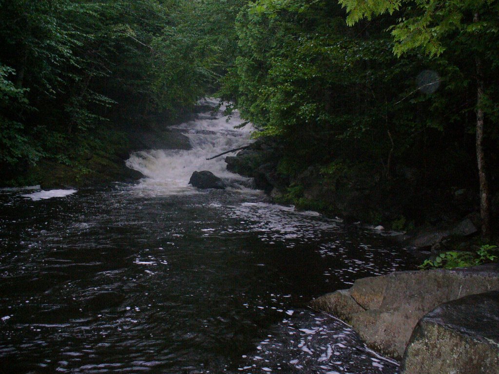
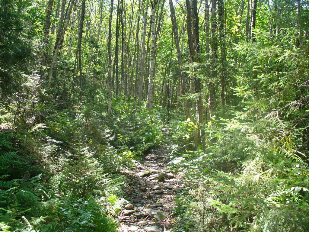
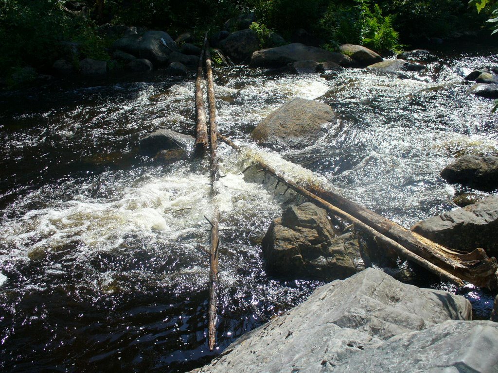
1. We had to walk along the Nahmakanta Stream for 6 miles... It had not overflowed its banks and the walk was pretty nice...
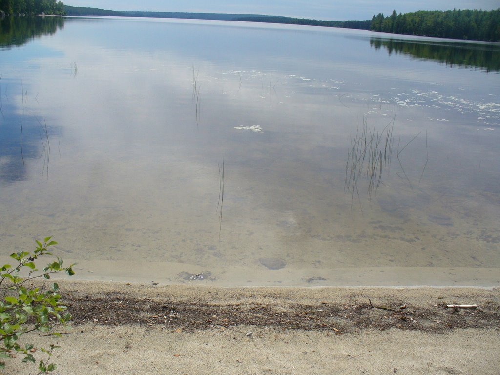
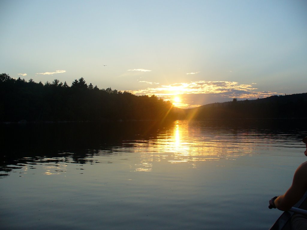
2. One of the sand beaches along the way... This one was at Pemadumcook Lake... These lakes have no buildings along their banks...
they are all pristine just like the land.
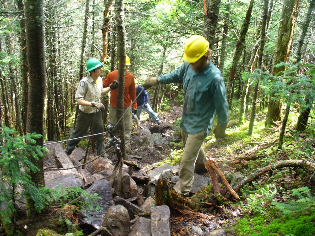
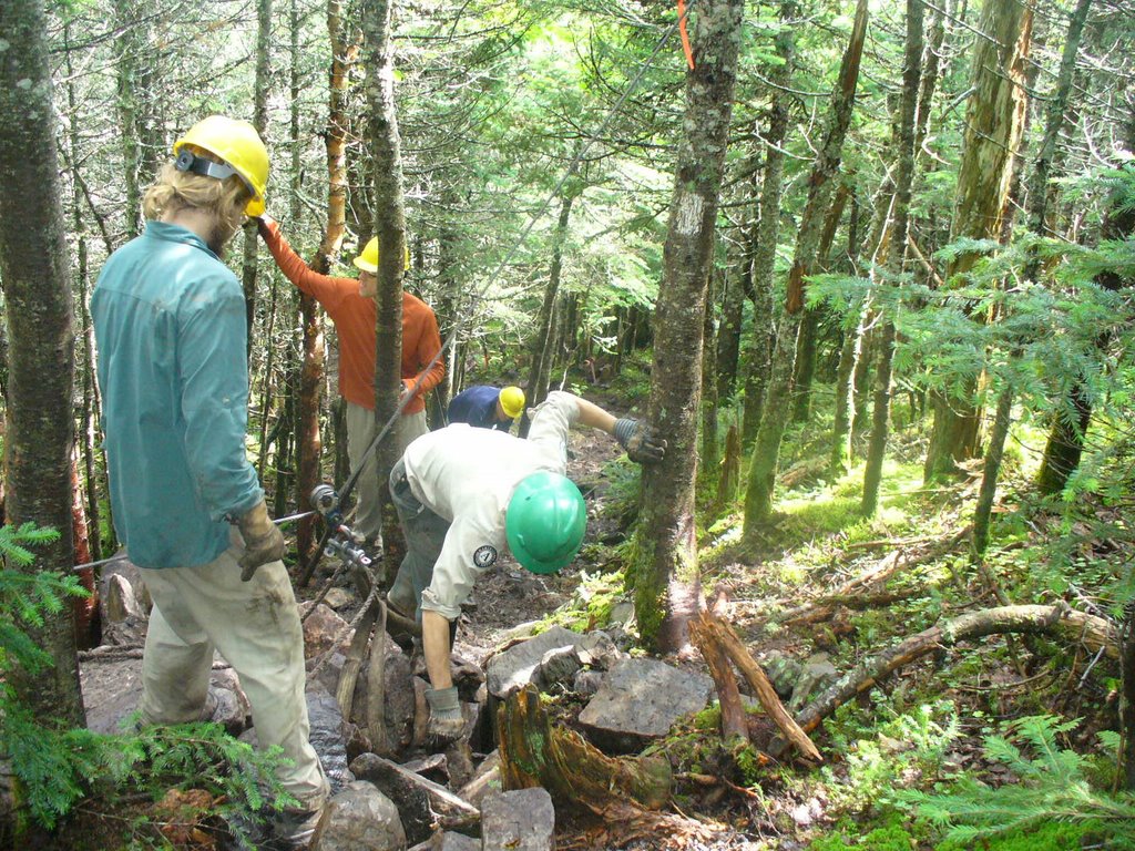
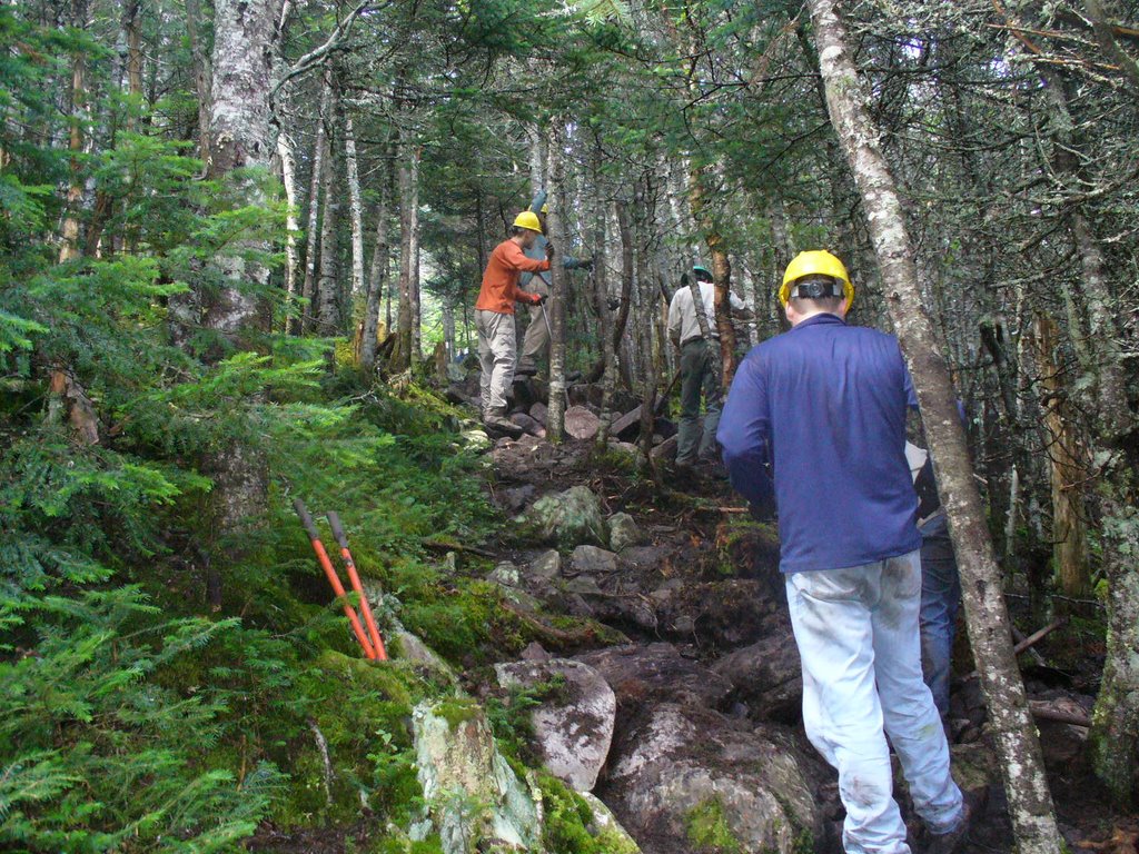
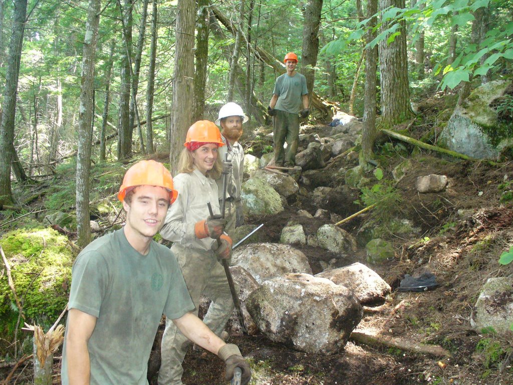
3. I had the pleasure of meeting this group from the MATC (Maine Appalachian Trail Club) and MCC (Maine Conservation Corps) I had passed their camp about 30min earlier, set up near my second picture, a lovely location. They were busy placing rock stairs on Nesuntabunt Mtn., a pretty big operation as I would come to see... Its hard work but this group like the others I had met along the way are quite a team and I could sense the camaraderie among the members. When asked how much longer they would be out here working, many responded by saying they had signed up for another 3 weeks...
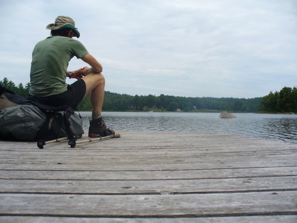
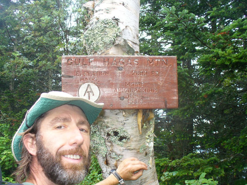
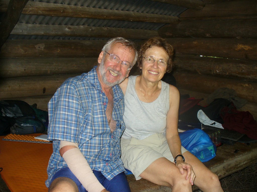
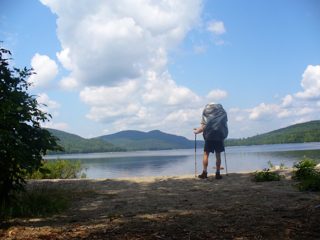
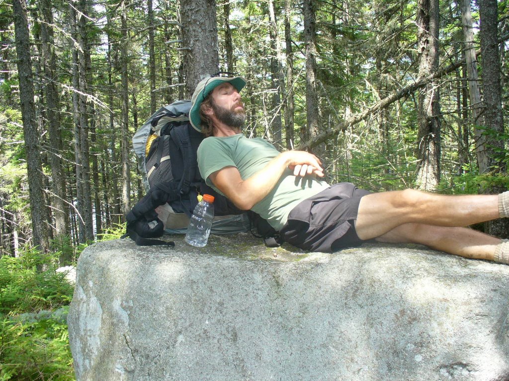
4. Thats me taking a break on the top of a nice rock... I had a chance to chat with my wife and brother from this point before nodding offf for a short, late morning snooze..
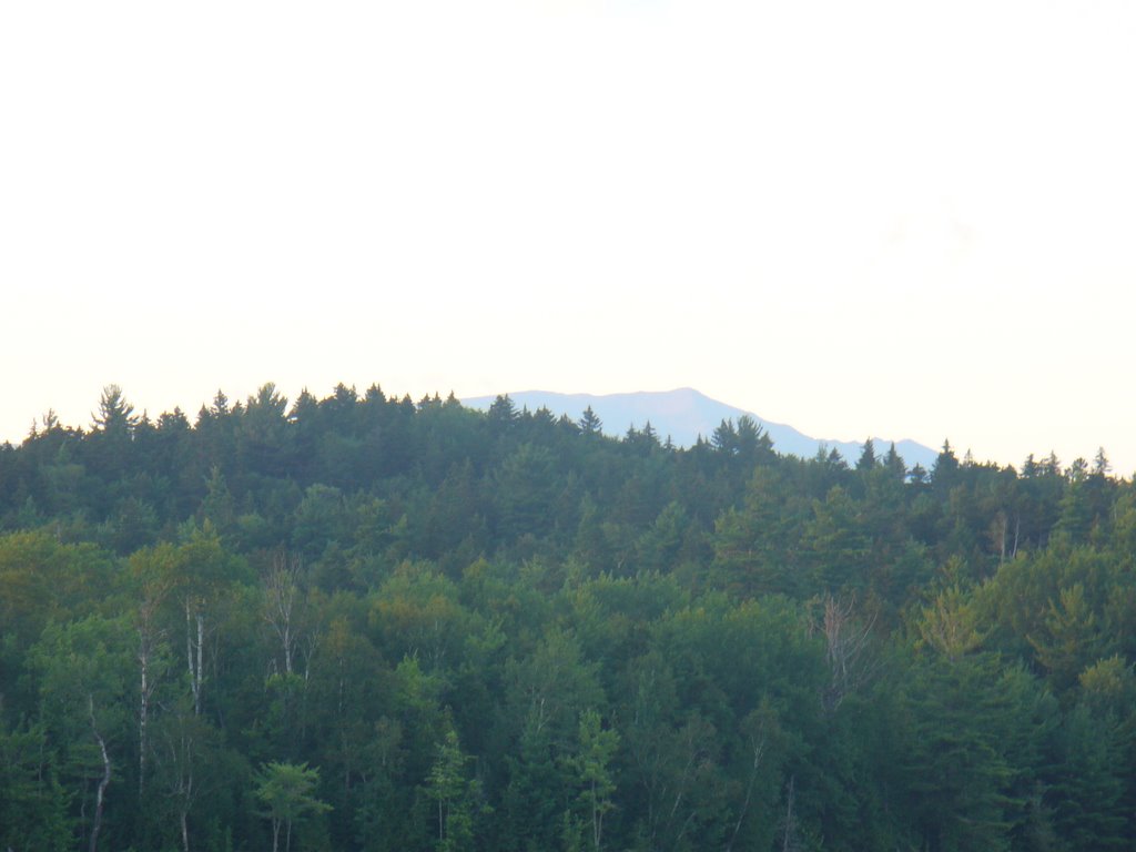
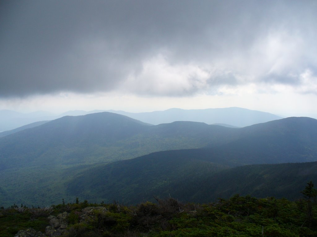
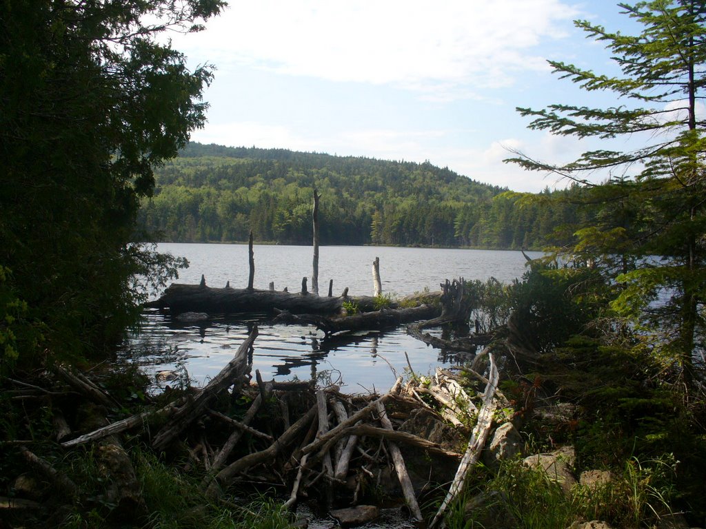
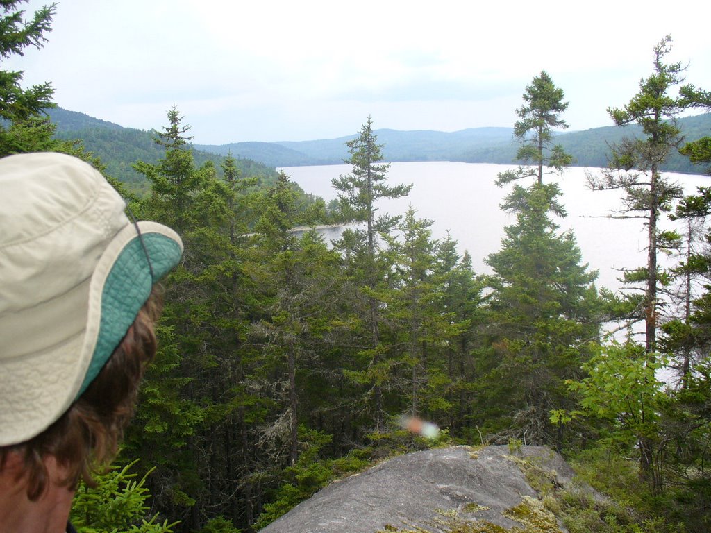
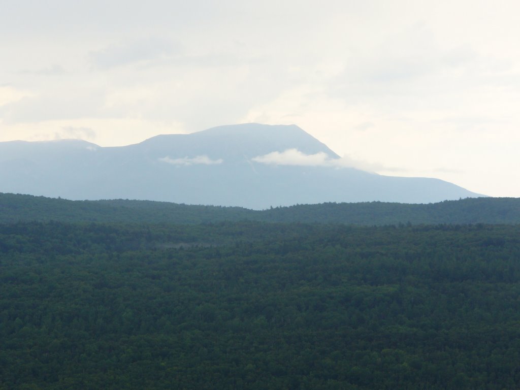
5. Views of Nahmakanta Lake from Nesuntabunt Mtn
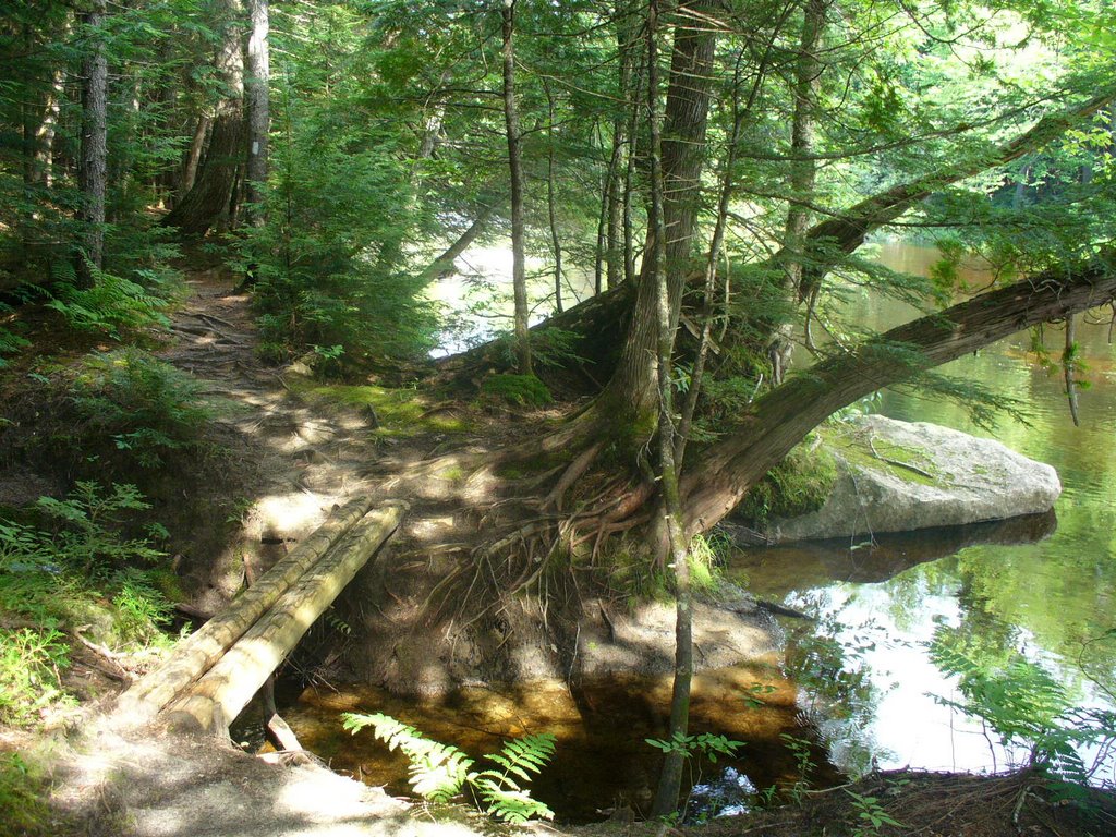
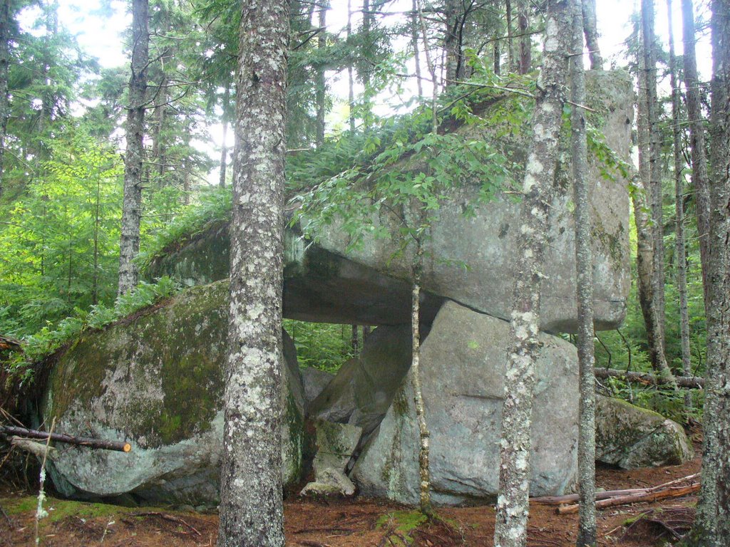
6. After leaving the Wadleigh Stream Lean-to, I came across this unusual rock formation with its rock roof...
7. View of Katahdin from Nesuntabunt Mtn.
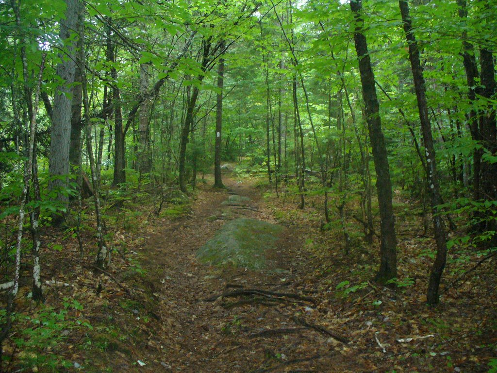
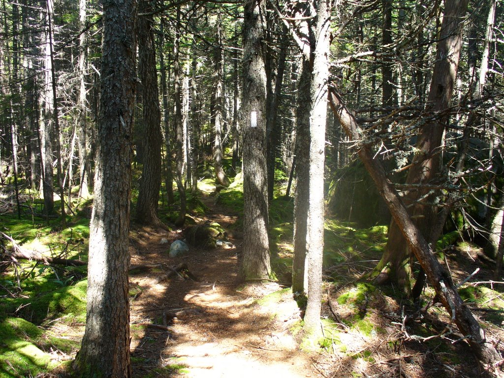
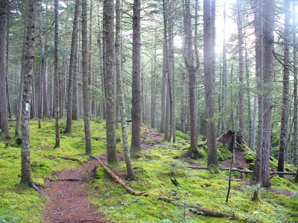
8. Nice trail encountered just after leaving Rainbow Stream Lean-to and before the T-storm hit. No other pictures were taken after this due to the rain...

Breakfast was served at 0800 and was quite filling with eggs, bacon, toast, coffee, juice, and AYCE blueberry pancakes. Breakfast concluded about 0900 with all the hikers paying their bills and finally the boat ride back to the dock for the walk back to the AT. We hit the dock at about 0930 and started making our way back to the swamped road and the AT... I had decided to bushwack just to the north of the swamped road where there use to be a trail according to the owners of White House Landing... Brian chose to keep his Crocks on and walk through the muddie waters and wash his feet 100yds down the trail in todays first streem crossing... I was putting my boots on at the dock when the second boat load was arriving with the boy scouts and they yelled at me to stop; they had found a camera they thought was mine... It was Brians and since we were hiking together for the next few days I took it. He was already 10min ahead of me so I started moving with the extra camera... When I arrived at the swamped tote road I entered the woods as I had planned and did find the remnants of an old trail... I followed it, with the tote road in site, and just as I reached the AT Brian called out for me... "You dont happen to have my camera do ya??" I replied: "You mean this thing" showing him the camera... His anxiety level fell and a big smile appeared on his face... He thanked me and I told him that the boy scouts had done a last walk through and found it on the ground and handed it to me just as I was about to leave the dock. I had arrived at the dock with my crocks on but decided there to bushwack instead. So I changed and put my dry boots back on... An interesting series of events....
Anyway I started heading north on the AT while Brian cleaned himself up at the stream just north of the tote road... He passed me a short time later, showing me his 3.0 mph walk which was near impossible for me to match... I took a break around 1330 on a rock outcropping above Nahmakanta Lake and phoned Jackie... I didnt realize it at the time but the day was slipping away due to the very late start.. I pushed on to the Wadleigh Stream Lean-to just in time to avoid the most intense rainfall I had seen on my entire trip on the AT... It lasted about an hour and allowed me to rest unfortunately only after finishing 8 miles with another 12 to go I was getting a bit concerned... As soon as the rain slowed I was headed north again an 4 hours later arrived at the next shelter covering another 8 miles... I stopped there for dinner and chatted with a southbound couple who were there for the night. They mentioned the trail north of the shelter was swamped in many places and I was sorry to say the trail south of there wasnt much better... I finished my dinner and decided to continue for the campground just 4 miles north, my original destination of the day... I would arrive at dusk, but completing these last 4 miles meant I would stay on schedule for a Sunday ascent with Brian and pick up by my family. I picked up the pace a bit shortly reached the west end of Rainbow Lake just in time to hear the sound of thunder. It wasnt long before the skies darkened and the rain began to fall. At this point I was wishing I had stayed at the last shelter... I pushed on for the campground but the trail was getting much worst... It was actually worst than what I had already passed through and in a short time my feet were soaked. The days light was quickly extinguished and replaced with the strobing light from the lightning... The rain wasnt falling too hard so I continued and finally reached the campground about 2100 to find it completely full of boyscouts... There were only 2 designated camping sites here but as I walked through the campsite I noticed 8 tents set up with at least 16 boys, all walking around and talking, most congragating under a tarp with a large lantern glowing. There were no spots to pitch my tent...:(... so I got my headlamp out of my backpack and continued on in the rain looking for a tentsite besides the trail... The trail was in very poor shape, much of it turned to small streams. This was the 3rd storm of the day and everything was waterlogged... I walked for about an hour and around 2200 I finally came across a rather nice spot under some fir trees... The rain diminished some as I set up my tent and soon I was inside removing my wet clothes and climbing into my sleeping bag... All my gear was dry thanks in part to the pack cover and in large part to the individual waterproof stuff sacs I started using in Virginia... It wasnt long before I fell asleep reminding myself I would conclude this trip in only 2 days.... :)

8/03/06 Thursday: Cooper Brook Falls Lean-to to White House Landing, Maher Tote road (13.8mi)


PICTURES:
1. Cooper Brook Fall just 50' in front of the Lean-to I stayed in last night...
2. A look again at the pool below Cooper Brook Falls from the shelter...
3. The trail was pretty nice for the most part wide and dry...
4. Another beach this time on Lower Jo-Mary Lake...
5. Thats me sitting on the dock waiting for the boat from Whitehall Landing to come pick me up... Only took 10 min from the time I sounded the air horn...
6. Cute outhouse at the hostel at Whilehall Landing.. No electricity out here, everything runs on propane including the icebox and lamps...
7. View from the porch of Whitehall Landing of Pemadumcook Lake
8. From the front of the Office/dininghall looking at a small rental cabin and the shower facility which is also hiding the bunkhouse where I stayed...
9. Pic of Whitehouse Landing office/store/dining hall from the docks
10. Picture of Mt. Katahdin taken from the other side of the Lake. I paddled over with a boyscout to get another look at the big Mtn...
11. While paddling back to shore after taking the Mt. Katahdin pic, I stopped to get this sunset pic.

Well the race was on to arrive at the White House Landing no later than 1300 for lunch to sample their 1lb burger...:)... I was on the trail by 0630 and with rather level terrain and the hopes of a dry trail I was off... The morning was overcast and the trail quite muddy leading to a lot of rock hopping to avoid the ankle deep mud and waters of the trail... The mosquitoes were quite ravenous as they had been for days and I thank God again for having purchased the 30% Deet repellant in New Hampshire... The bottle was nearly empty now and I only hoped that I had enough of the stuff to finish the trip... I arrived at the tote road leading to White House Landing around 1145 and saw in was under 1 to 2 feet of water... There was no way to pass through it without getting your boots wet... And I had spent the morning rock hopping successfully and had arrived here with relatively dry boots...:(... Well I still had about a mile to go and wasnt about to mis out on my burger...:/... So in I plunged with a few steps leading to water entering through the tops of my boots, I was soon through the worst of it and the trail dried up considerably... I continued on down to the dock and sounded the air horn one short blast as directed by the message there... Soon a boat was headed in my direction and I was wisked away to a more comfortable resort type environment... I went straight for the restaurant and placed my order at 1245, plenty of time to spare...;)... I decided to spend the night there leaving me with 2 twenty mile days to the base camp of Katahdin... The owners showed me around the place and I set myself up in the bunkhouse with another through hiker-Brian... Brian was a 19y/o young man from the Allentown, PA area... We hit it off pretty well at dinner that night and by breakfast we had made plans to ascend Katahdyn together on Sunday... Later that evening a group of boyscouts joined us in the bunkhouse and after dinner I went for a canoe ride with one of them to get a picture of Katahdin from the other side of the lake... I slept well that night and was packed and ready to go for an early morning departure after breakfast which was to be server at 0800 sharp...

8/02/06 Wednesday: Carl A. Newhall Lean-to to Cooper Brook Falls Lean-to (18.9mi)


PICTURES:
1. Took my picture at the summit of Gulf Hagas Mtn...Not very high as you can tell from the size of the trees there, but a unique sign did prompt a picture...
2. Largest, reddish mushroom I had seen on the trail near the summit of Gulf Hagas Mtn.
3. Clouds were beginning to break again when I reached the last major summit before Katahdin... Still 73 trail miles to Katahdin but all those miles would be done below 2000'.
4. A picture north from White Cap Mtn of Katahdin in the mist...
5,6,&7. Came across this work crew on the NE side of White Cap Mtn installing rock stairs to help alleviate the erosion problems so common with many mountain on the trail... The rocks are just under the surface of the trail or near the trail and with the pulley system they hoist them up and into place. Touch work by some dedicated people from the MATC and MCC..
8. Heres Slowpoke and Spindleshanks having lunch with me at the Logan Brook Lean-to, about half way down the North side of White Cap Mtn. The are section hikers from North Carolina focusing on the 100 mile wilderness. They tented last night at the Sidney Tappan Campsite on near the summit of Gulf Hagas and were swamped in their tent during the 2 hour downpour... They were in remarkably good spirits inspite of waking up wet and the few falls and minor injuries already sustained along the first 1/3 of the trail up here...
9. Some tricky footing encountered with plenty of rocks and roots. Here I'm passing through a hardwood section of forest with a clearing
10. Here is the predominant forest trail in Maine through a stand of pines..
11. Fording the East Branch of the Pleasant River was not for the faint of heart... strongest current and worst footing of all the fords... I made it across without incident not walking on those trees but slightly downstream from them... Some hikers use those treetrunks across the stream to hang on to as they cross...
12. One of many beaver dams along the trail... This one was daming Crawford Pond.. The trail is noticably lower than the level of the pond...Im glad the beavers do good work...:)...

We rose to blue skies which clouded over by 0800 for the day...The previous nights severe t-storms left many sections of the trail there muddied or just plain swamped... We were fortunate to be spending much of the day at the higher elevations, away from known swamps and lowland regions... The summit of Gulf Hagas was cloud covered, but the temperature was perfect for hiking, about 68 degrees... I walked through the Sydney Tappan Campsite and noticed many of the tentsites were swamped. This was the primary destination for my hike yesterday and I was quite happy to have stopped short at the Newhall Lean-to... I proceeded along toward White Cap Mtn which has tremendous views in every direction, including views of Katahdin, on clear days...:/... So I was hoping for the weather to improved and some of these clouds to go away... Well, my prayers were answered... I reached the top of White Cap Mtn and the sun finally broke through. The clouds began to thin some and the views were fantastic, including that of Katahdin... I couldn't get cell reception on the summit but a few minutes later on the descent I called Jackie to check in and let her know I was thinking of her... I continued on to the Logan Brook Lean-to for lunch, 1.5miles from the summit and 7 miles from the start of my day... After taking a 1hour break for lunch, I returned to the trail and continued north to the next challenge of the day... The East Branch of the Pleasant River needed to be crossed... This was to be the most difficult for yet due again to the boulder like rocks and subsequent crevases, uneven bottom, and strong current... I did make it across without incident and after putting my boots back on continued north... A few hours later, I was able to phone Jackie again from some open ground on Little Boardman Mtn. The late afternoon walk looked good on the map and with ample time left to the day I decided to take another break. Just relaxing on the open rock face of the mountain in the sun, giving my boots and socks time to dry from the puddles of the morning was quite nice... Often when you reach the shelter the sun is so low in the sky that nothing dries... Of course, you can't help by hope that the rest of the days terrain would be well drained, not too swampy...;)... I arrived at the Cooper Brook Falls Lean-to at 1900 and had it all to myself all night... Shortly after my arrival the clouds formed overhead and the rain started again... It rained most of the night but would again clear in the early AM...:)... I fixed myself some dinner and retired early, looking forward to tomorrow that would include lunch at WhiteHouse Landing and possibly an overnight stay there too...

8/01/06 Tuesday: Cloud Pond Lean-to to Carl A. Newhall Lean-to (16.8mi)


PICTURES:
1. Cloud Pond at 0615, I was drawing some drinking water from the pond on my way north...you can see the raindrops in the pond... was just a lite shower which passed quickly...
2. The Barren/Chairback Range: View of Third Mtn in the forground and Chairback in the distance from the summit of Fourth Mtn...
3. While descending Chairback, snapped a shot of Gulf Hagas Mtn and White Cap...tomorrows challenge...
4. I hiked a few hours in the afternoon with this section hiker... He did a thru hike last year but was swepted down a stream after slipping on some large boulders.... His friends were a bit ahead of him and he decided to return to Monson and get a ride around the water crossing. So he is back this year to complete the section he missed last year... We took a few minutes at the West Branch crossing of the Pleasant River, the end of his trek and the completion of the AT for him... We celebrated with a soda and chatted about some of our experiences before bidding each other farewell. He left in his pick up and headed south to visit with friends before returning to Indiana and I removed my boots yet again to ford the Pleasant River West Branch viewed in Picture #5.
5. Easy Ford of this wide shallow river... West Branch of the Pleasant River
6. I had some lovely walks in the woods during the afternoon hours...

I was the first out of the shelter at about 0600, with another big day planned. I wanted to make it to a campground half way up the next and final mountain range before Katahdyn... Another 20mile day... After spending a few hours walking north of Cloud Pond, I came to the conclusion that the day might be shorter than previously expected... The mountain range was 15 miles long with multiple peaks and valleys. A real challenge and quite exhausting... At 1130 I arrived at the Chaiback Gap Lean-to... I had covered 7 miles in 4 1/2 hrs... I was exhausted and needed a boost to carry on.. I decided to take some time to carb up here so I decided to cook and eat 4 of my meals for lunch... Well that hit the spot... I did have trouble getting the fourth one down but after finishing lunch I began to feel a lot better and started again on my way north... I had some nice views from Chairback Mtn, and could see the next mountain range of the day fast approaching... Gulf Hagas Mtn and White Cap Mtns would be the last mountain range before entering the "Lakes region" of the 100 mile wilderness.. 50 miles of short climbs and descents around dozens of lakes, many of which were completely uninhabited by man (no camps, boats, etc..) Only the AT and some logging roads... I finished my descent of Chairback and had to ford the west branch of the Pleasant River before entering the Gulf Hagas area, the "Little Grand Canyon" of the East. The ford was again difficult and added another 30min to my trip but though stressful was uneventful. I had visited Gulf Hagas before and decided I did not have the time to visit it today and make it to the shelter up Gulf Hagas Mtn... So I passed by the side trail leading to it on this trip... I would be back in the future to again walk through its awe inspiring canyons and watch the multiple falls. I met many families day hiking through the AT section of the Gulf before leaving the Gulf and heading up Gulf Hagas Mtn... Most of the afternoon was a lovely walk along Gulf Hagas Brook before finally arriving at Carl A Newhall Lean-to. There were two section hikers there and they moved over a bit to make room for me in thid 6 person shelter... I could begin to hear thunder in the distance and decided to call it a day here. So I had another 2 meals for dinner and prepared my section of the shelter for spending the night... I chatted with the other two hikers, 2 women who met after one of the women from Mississippi placed an add in the AT Journeys magazine. They had become best of friends and had hiked all over the US together from the PCT in Califournia to many different sections of the AT... We all had quite a show that night in the shelter with a severe series of thunder storms passing through the thunder was loud with the lightning illuminating the woods surrounding the shelter... I slept well and we all would wake to a beautiful morning, though wet from the torrential downpour from the nights storms...