Appalachian Trail Experience 2006: Just Gene

My AT adventure began on 4/4/06 at Springer Mtn was completed on 8/6/06 at Mt Katahdin. I averaged 18mi/day with an average pack weight of 40lbs. I resupplied every 2 weeks via mail drops and spent lots more money on food along the trail. I took a total of 8 days off spending 6 of them with my wife. I'm looking forward to doing it again...a bit more slowly the next time...:)

Wednesday, April 12, 2006

April 12, 2006: Betty Creek Gap to Winding Stair Gap, Franklin, TN (Budget Inn) (12.2 mi)


April 12, 2006
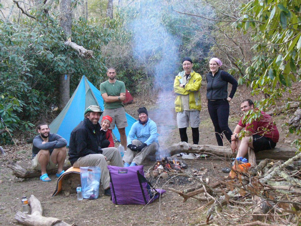
What a wonderful day for hiking!!! The night wasn't too cold, probably high 40's, so I slept a little better. The morning greeted me with no condensation on the tent inside or out...nice... nothing wet to lug around all day. Early was chilly in the 50's but climbed to the 60's with some cloud cover to keep the sun from pounding us as in previous days. Remember were walking in a hardwood forest early spring with no leaves on the branches. The only cover weve had has been from the Rhododendrum trees along the way. And they are so numerous...it must be a truely amazing site when they are in bloom. I will have to return some day in May!! We are up by 0730 today and Im off at 0800 while Joe sorts out his gear and is off at 0815. We walk the first half of our 12 mi day and rest our sore feet at a place called Glassmine Gap at 1100, which just happened to be the 100.3 mile mark of the trail. We phoned ahead to Franklin to check on room availability...thank God for cell phones... The hotel offered to drive out the 11 miles to get us and they had internet, restaurants and laundry nearby and a warm shower for $34. Sounds good to us... We got to the end of our day and our 12 miles at about 1400 and got picked up at 1430. Had Large pizza delivered for a late lunch and went to an AYCE (all you can eat) steak buffet for dinner at 1900. Right now I can hardly move from the AYCE. LOL... Were moving out in the moring for another 16mi day. Till next time...
1. Thats me performing a recurring chore, fetching water and treating it before I drink it.
2. Nice view with Joe and I from the trail looking N
3. Thats Joe and I posing from the summit of Albert Mtn 5,250ft that was quite a climb, short but quite steep.

April 11, 2006: Whiteoak Stamp to Beech Gap (16.5mi)


April 11, 2006
Yesterday we had a late start and some tough terrain. Today its a different story. A couple of tough climbs but just gentle rolling hills for the most part. A lovely sunny day in the 70s ending @ 1600 with our arrival @ Betty Creek Gap. A great day with our best milage so far....16.5mi. These pics are in proper order.

1. This sign box greeted us into a section of the Nantahala ( Thats Cherokee for: Land of the noon day sun) Can you read the note about the bear running amock!!! LOL
2. Thats me posing by the sign post.
3. The rhododendrums are all over this part of the mountains...wild...must be beautiful in bloom...There are plenty of buds ready to pop...looks like were just missing the floral show by a week or two...
4. Group pic at our camp site... Joe and I decided to by-pass the shelter and its campsite for this less frequented one...LOL As you can see this one ended up full too... Lots of folks with the same dreams...all taking them to Katahdin... From LtoR: Dave hiking with his Dad (not present..Wayne)who was taking a nap, Me, Wild Poodle (trail name), Joe (standing), Cindy (hiking with Wild Poodle), Bill, Laura, and Phil. We had a really nice time eating around the fire ring, later having a fire and chatting about things past and things to come.

April 10, 2006: Dicks Creek Gap to White Oak Stamp (12.3mi)


April 10, 2006

We had a nice dinner last night at the Georgia Mountain Cafe in Hiawassee... Joe and I both had the special: Fried Chicken, 3 side dishes, and dessert for $4.50...nice deal and quite a nice change from the freeze dried stuff... We got up to sunny weather and temps reaching the 80s. It took us a little while longer to hitch out to the trail but we got out there @ 0930 to begin our day. Pics are in reverse order again...sorry...Im suppose to pick them in reverse order so they come up properly.
1. Start the day with these signs indicating your whereabouts. Dicks Creek Gap is Hwy 76 to Hiawassee.
2. Joe posing by a sign indicating our approach to North Carolina
3. Thats Richard, Me, and Joe posing by a small sign indicating the Ga/NC border
4. Just before leaving Georgia, more lovely patches of wild flowers lining the trail.
5. We bi-passed the shelter by about a mile, got plenty of water and settled in for the night at this remote Gap.

6. Joe and I chowing down before we start the fire for another quiet night...It got down to the low 40's on this night... Just a bit chilly....