8/02/06 Wednesday: Carl A. Newhall Lean-to to Cooper Brook Falls Lean-to (18.9mi)
PICTURES:
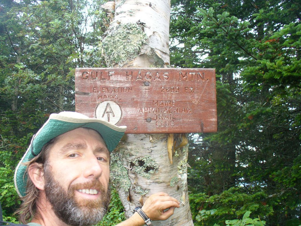
1. Took my picture at the summit of Gulf Hagas Mtn...Not very high as you can tell from the size of the trees there, but a unique sign did prompt a picture...
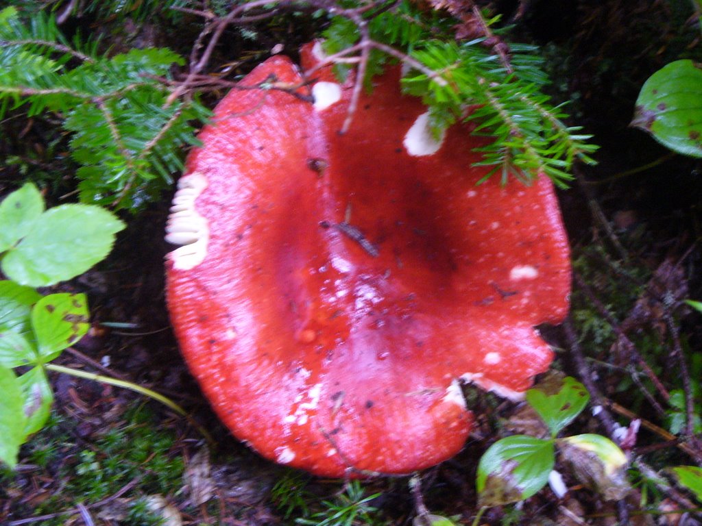
2. Largest, reddish mushroom I had seen on the trail near the summit of Gulf Hagas Mtn.
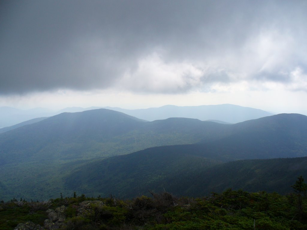
3. Clouds were beginning to break again when I reached the last major summit before Katahdin... Still 73 trail miles to Katahdin but all those miles would be done below 2000'.
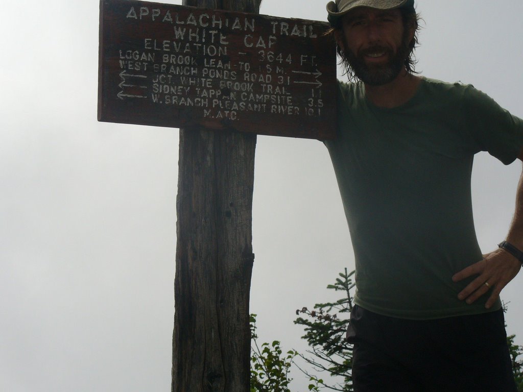
4. A picture north from White Cap Mtn of Katahdin in the mist...
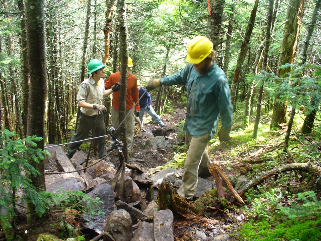
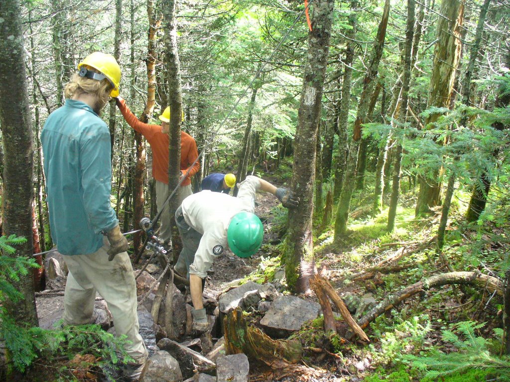
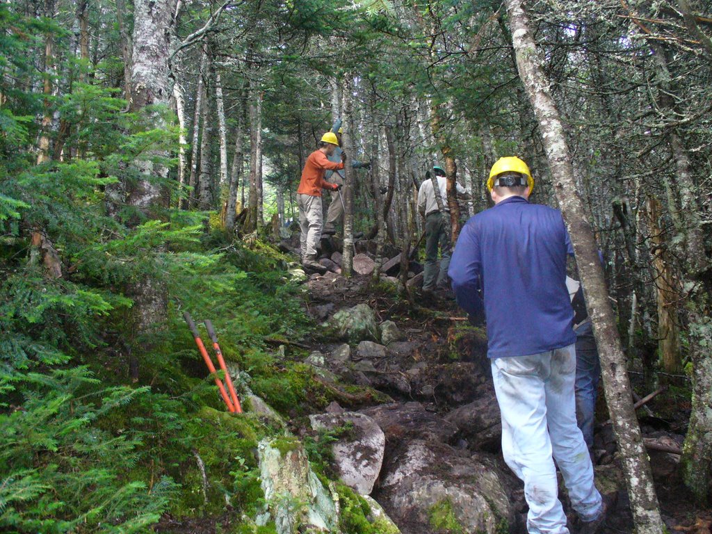
5,6,&7. Came across this work crew on the NE side of White Cap Mtn installing rock stairs to help alleviate the erosion problems so common with many mountain on the trail... The rocks are just under the surface of the trail or near the trail and with the pulley system they hoist them up and into place. Touch work by some dedicated people from the MATC and MCC..
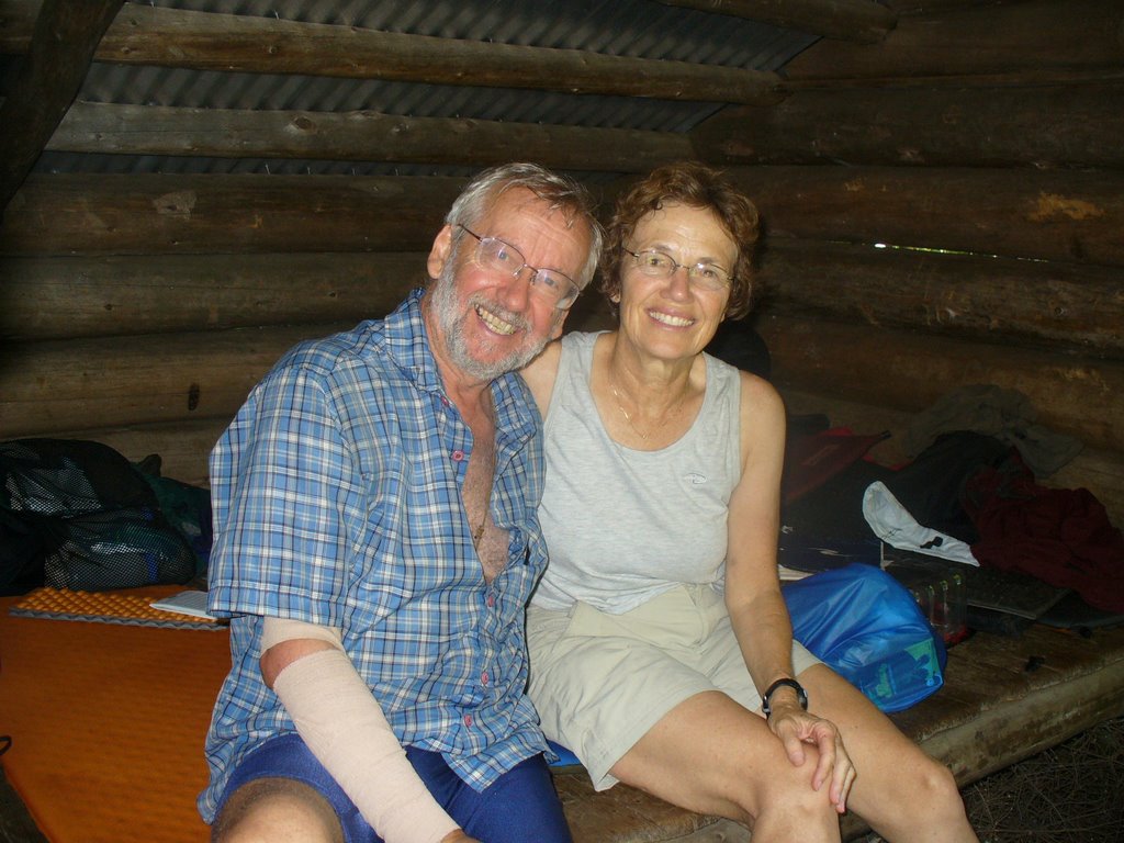
8. Heres Slowpoke and Spindleshanks having lunch with me at the Logan Brook Lean-to, about half way down the North side of White Cap Mtn. The are section hikers from North Carolina focusing on the 100 mile wilderness. They tented last night at the Sidney Tappan Campsite on near the summit of Gulf Hagas and were swamped in their tent during the 2 hour downpour... They were in remarkably good spirits inspite of waking up wet and the few falls and minor injuries already sustained along the first 1/3 of the trail up here...
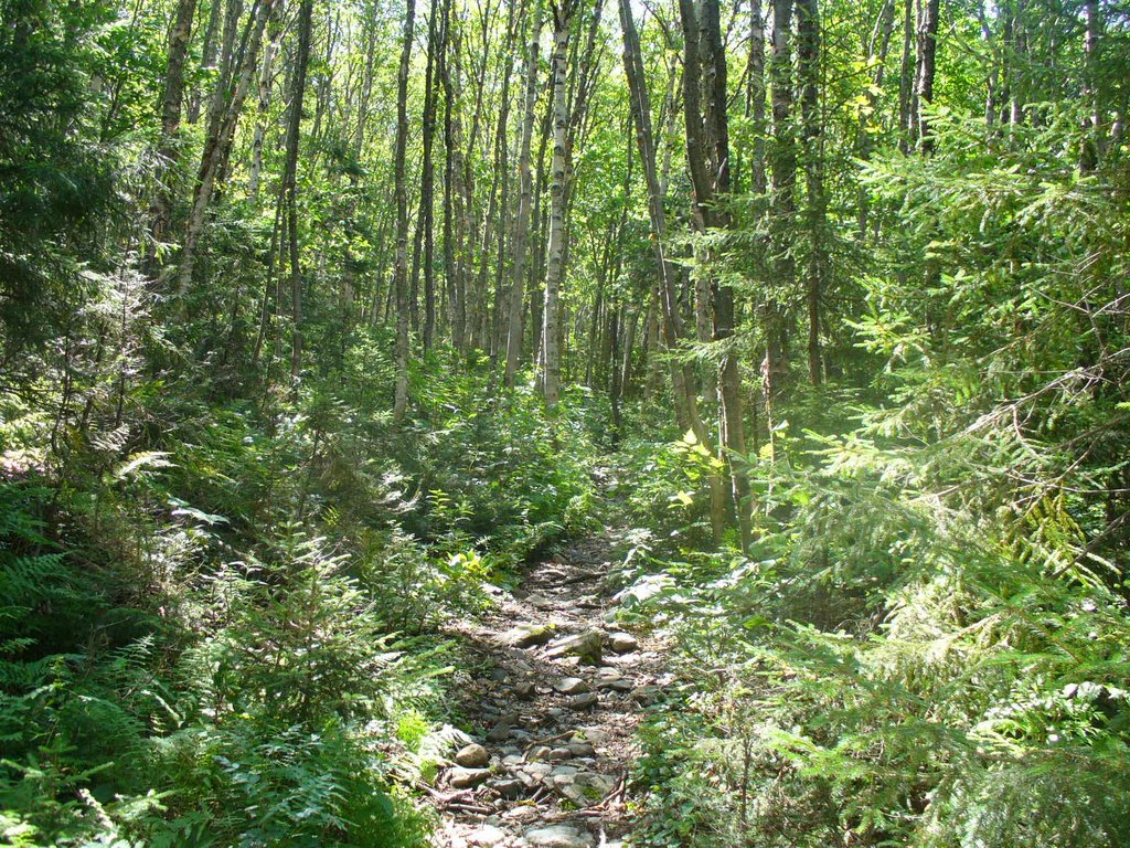
9. Some tricky footing encountered with plenty of rocks and roots. Here I'm passing through a hardwood section of forest with a clearing
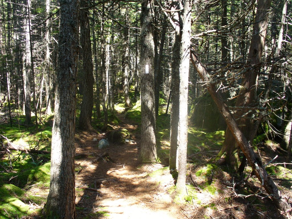
10. Here is the predominant forest trail in Maine through a stand of pines..
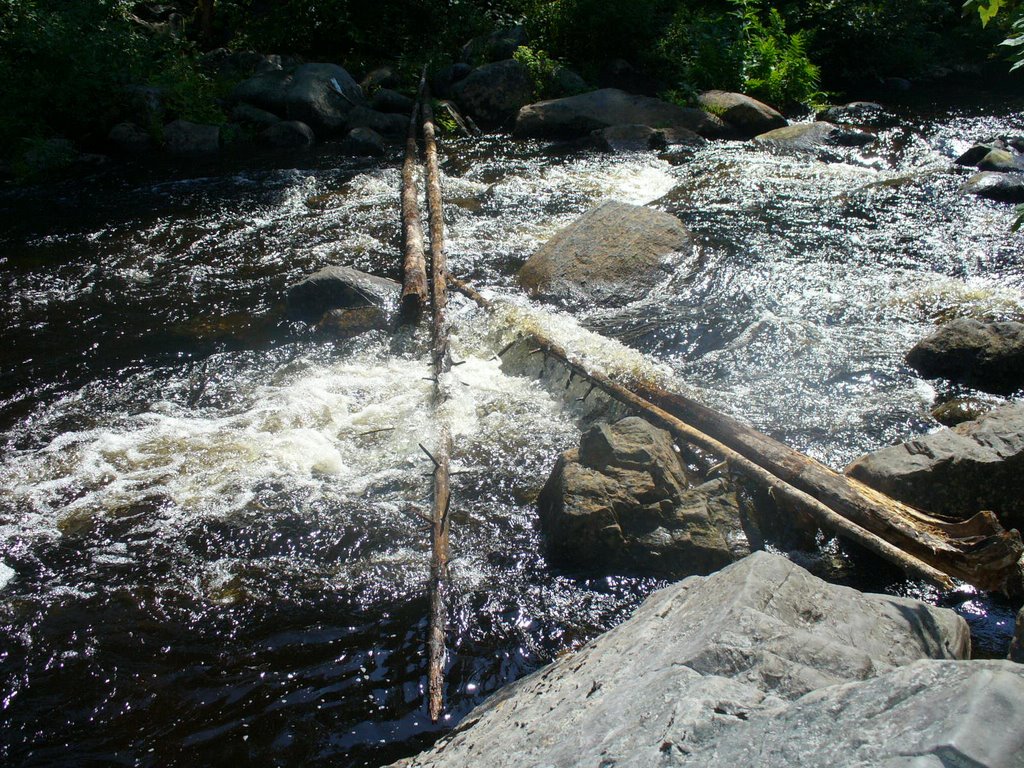
11. Fording the East Branch of the Pleasant River was not for the faint of heart... strongest current and worst footing of all the fords... I made it across without incident not walking on those trees but slightly downstream from them... Some hikers use those treetrunks across the stream to hang on to as they cross...
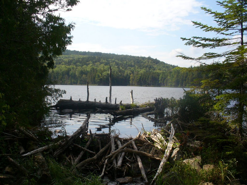
12. One of many beaver dams along the trail... This one was daming Crawford Pond.. The trail is noticably lower than the level of the pond...Im glad the beavers do good work...:)...
We rose to blue skies which clouded over by 0800 for the day...The previous nights severe t-storms left many sections of the trail there muddied or just plain swamped... We were fortunate to be spending much of the day at the higher elevations, away from known swamps and lowland regions... The summit of Gulf Hagas was cloud covered, but the temperature was perfect for hiking, about 68 degrees... I walked through the Sydney Tappan Campsite and noticed many of the tentsites were swamped. This was the primary destination for my hike yesterday and I was quite happy to have stopped short at the Newhall Lean-to... I proceeded along toward White Cap Mtn which has tremendous views in every direction, including views of Katahdin, on clear days...:/... So I was hoping for the weather to improved and some of these clouds to go away... Well, my prayers were answered... I reached the top of White Cap Mtn and the sun finally broke through. The clouds began to thin some and the views were fantastic, including that of Katahdin... I couldn't get cell reception on the summit but a few minutes later on the descent I called Jackie to check in and let her know I was thinking of her... I continued on to the Logan Brook Lean-to for lunch, 1.5miles from the summit and 7 miles from the start of my day... After taking a 1hour break for lunch, I returned to the trail and continued north to the next challenge of the day... The East Branch of the Pleasant River needed to be crossed... This was to be the most difficult for yet due again to the boulder like rocks and subsequent crevases, uneven bottom, and strong current... I did make it across without incident and after putting my boots back on continued north... A few hours later, I was able to phone Jackie again from some open ground on Little Boardman Mtn. The late afternoon walk looked good on the map and with ample time left to the day I decided to take another break. Just relaxing on the open rock face of the mountain in the sun, giving my boots and socks time to dry from the puddles of the morning was quite nice... Often when you reach the shelter the sun is so low in the sky that nothing dries... Of course, you can't help by hope that the rest of the days terrain would be well drained, not too swampy...;)... I arrived at the Cooper Brook Falls Lean-to at 1900 and had it all to myself all night... Shortly after my arrival the clouds formed overhead and the rain started again... It rained most of the night but would again clear in the early AM...:)... I fixed myself some dinner and retired early, looking forward to tomorrow that would include lunch at WhiteHouse Landing and possibly an overnight stay there too...
posted by "Just Gene" (trail name) @ 14:09
![]()
![]()


0 Comments:
Post a Comment
<< Home